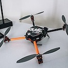
The Harrier crew with their drones, from left: operations manager Peter LeCouffe, director Robert Simmerling, P.Eng, and geomatics technician Steve Jo
The Harrier crew with their drones, from left: operations manager Peter LeCouffe, director Robert Simmerling, P.Eng, and geomatics technician Steve Johnson. — Bailey Repp photo courtesy Harrier Aerial Surveys
What if a prospector carried not a pick and shovel, but a piece of technology that looks like a miniature airplane or helicopter? That future is already here, and Harrier Aerial Surveys in Nelson, B.C., has two drones ready to search for minerals.
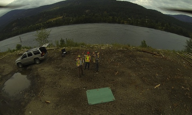
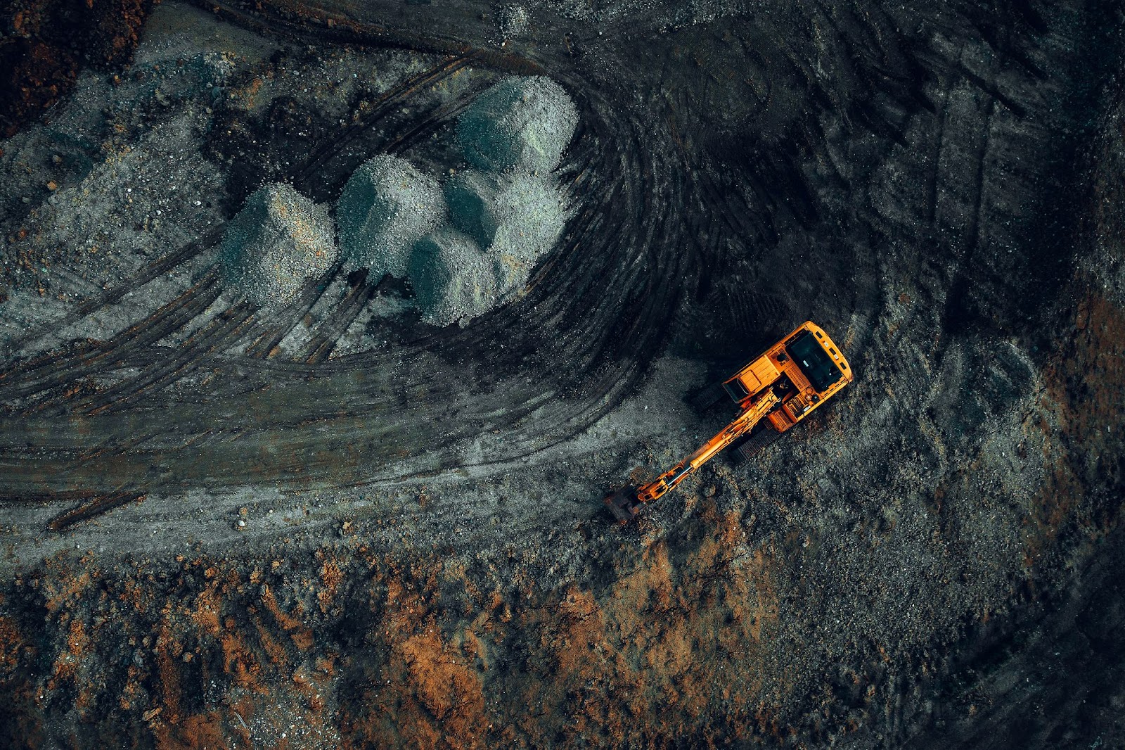
Mining companies globally are using drones for everything from mapping to mineral exploration to tracking stockpiles. Valuable information can lead to better decision-making, said Peter LeCouffe, co-owner of Harrier with professional engineer Robert Simmerling.
“Like with the open pit mines,” said LeCouffe, “it would be very beneficial to have an accurate terrain model, and then on a day-to-day basis know how much material has moved. And then also in the exploratory side of things, terrain models before and after mines are built.”
How do drones find minerals?
“Multi-spectral imagery,” said LeCouffe. “It’s seeing outside the red, green and blue bands of the electromagnetic spectrum. Different ore bodies will have different spectral signatures, so with computer processing we can potentially figure out where those ore bodies are.”
The company is named for both the Northern Harrier hawk and the Harrier Jump Jet, a military aircraft that can take off vertically. LeCouffe and his colleagues fly two different unmanned aerial vehicles (UAVs): one that resembles a fixed-wing airplane, and one that looks like a spider with four little helicopters attached. They were manufactured in Switzerland and South Africa and require quite a bit of training to get airborne.
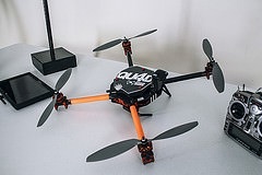
“It's stable,” LeCouffe said about the quad copter. “It's got four different rotors and the payload is in the centre of it. So it is stable on those different axes. From there we have a camera hanging off of it and we fly grid patterns with that to do the overlapping photos for a mapping project. Or we have a gimbal on the front for getting into close areas and getting photographs.
“It travels vertically as well as horizontally,” LeCouffe said. “So we can hover around and we can get into tighter spots than we could with the plane. And we can get into spots that you wouldn't necessarily want to send somebody to go and take a look. So whether it's environmental hazards or just height, fall hazards, whatnot, we can get in there.”
It’s not all fun and flying. LeCouffe has an environmental technology diploma from Camosun College, an advanced GIS diploma from Selkirk College, and is working on a bachelor’s degree in the field. In addition, a drone operator flying for profit anywhere in Canada needs a license called a Special Flight Operator’s Certificate.
“You have to cover all kinds of things like the vehicle’s specifications, the purpose of the flights, the location of the flights, and emergency procedures,” said LeCouffe. “Also liability, so your insurance and previous experience and who’s going to be piloting it.
“That’s a certificate that I have to apply for every year,” said LeCouffe. “You apply for a specific area on a specific date with a specific system, a few times until Transport Canada is comfortable with giving you what’s called a blanket certificate. I’ve got two blanket certificates now, one for my fixed wing and one for my quad copter. Within certain guidelines I can fly wherever I want in B.C., for a full year. That includes controlled airspace, but there (are) limitations within that as well.
“Just yesterday I met up with NAV Canada at the Cranbrook Airport, because I might be flying within their airspace soon, so just to find out what their procedures are and how they want me to go about flying in their space.”
In Canada, drones can’t fly higher than 400 feet, so the only manned craft they would encounter is a helicopter. Laws say they must always give way to a manned flight.
“If ever I'm within controlled airspace,” said LeCouffe, “then the airport will file what's called a Notice to Airmen, and then they'll say, okay, in this area there's a UAV flying, so be careful.”
If birds ever take more than a passing interest, there are evasive maneuvers which drones can perform. LeCouffe can direct the drone to do a barrell roll, a steep climb or a steep dive.
“So far we haven't had an issue,” said LeCouffe. “When I was first getting a demo in Calgary by the supplier there was a hawk that was interested, but never ended up coming close to this one. And speaking of birds, it looks like a bird up there—the black outline and everything. Once it's up there it could just be another raven.”
Harrier's drones
Fixed wing
- Sensefly Ebee
- 45 minute long endurance
- high efficiency large area coverage
- one metre wing span
- RGB, near-infrared and multispectral payloads
Multi rotor
- SteadiDrone Qu4d
- 15-20 minute flight time
- perch and stare capability
- highly maneuverable close range
- video and still photo inspections
Author

Kerry Shellborn
Filed Under
Related Stories
Satellite Insights into Mining’s Ecological Impact
More than 3 days ago

Saskatchewan's Potash may be Canada's Trump Card
More than 3 days ago

National Energy Emergency
More than 3 days ago
MCF Energy’s CEO James Hill on Fueling Europe’s Next Energy Renaissance
More than 3 days ago

Westshore Terminals Coal Fire 2024
More than 3 days ago